The Rise And Fall Of Boko Haram’s Sambisa Settlements As Seen Through Satellite Images
Satellite photos give a glance into the emergence, growth, and disappearance of settlements around Sambisa forest, a notorious safe haven for insurgents waging a brutal war against Nigeria.
Publicly available satellite images and open-source information provide a valuable breadth of view into Boko Haram’s expansion and cat-and-mouse game with the military around the Sambisa forest, the vast savannah woodland now synonymous with the twelve-year-old insurgency in Northeast Nigeria.
The Sambisa forest and adjoining areas were once known as a sanctuary for wildlife and part of a game reserve situated in the Chad Basin National Park. After analysing images of some of the settlements in the area, HumAngle observed notable changes in the construction of shelters that occurred after 2014 when the insurgency reached its peak and the terror group dominated the area.
Photos and videos from military operations alongside Google Earth satellite images give rare insights into the group’s exploitation of the geography and the nature of settlements, which are usually constructed using natural and accessible materials such as earth, straw, and corrugated iron.
During the recent military incursion in the area, the advancing troops encountered relics of destroyed buildings as well as shelters used by the insurgents and often situated beneath a canopy of trees to conceal them from surveillance and attack aircraft.
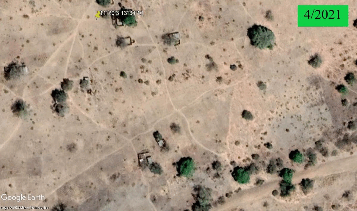
As part of the operation codenamed Desert Sanity, troops swept through the Njimia-Alafa-Camp Zairo axis of Sambisa with the Army releasing a picture of destroyed shelters in the geotagged location. Satellite imagery of this location also reveals the shift from a green landscape to an area with buildings and access roads.
The area is 14.1 km from the debris of the crashed Alpha Jet (NAF475) that went missing with two crew members last year and about 1.2 km from the Njimia area where the military in March destroyed a Suicide Vehicle-borne Improvised Explosive Device (SVBIED) employed in a defensive role by ISWAP. The terror group had earlier deployed a SVBIED in an attempt to thwart military operations in Arra, about 16 km from Njimia.
Satellite imagery indicates that a previous community existed in the area before 2011 and a rapid expansion occurred in 2014 alongside changes in the layout and construction of buildings. Images from 2016 and 2017 show widespread destruction and the presence of roofless buildings. These damages were likely related to a 2016 clearance operation by the military. In early 2018, what appeared to be new buildings sprang up but they vanished months later. However, farming activities and shelters were observable nearby.
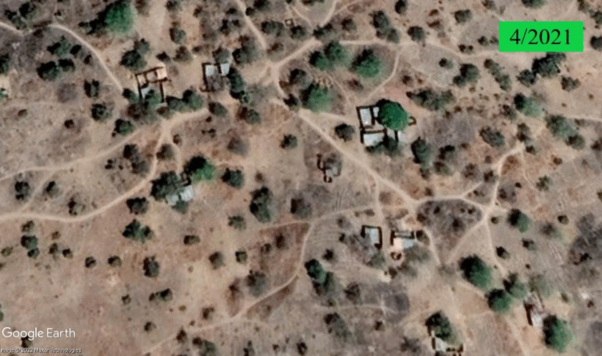
In 2020, the Air Force shared a video showing airstrikes carried out at the Njimia area after intelligence, surveillance, and reconnaissance missions led to target detection. The area continued to evolve with the appearance of new shelters in 2021, particularly along a major road that connects the area to Dure I in the west and Dure II in the east.
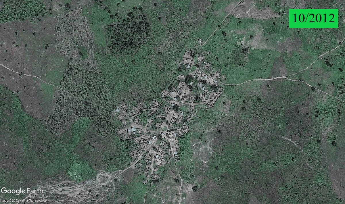
Dure is located within the general area of Sambisa near Njimia, Alafa, and Camp Zairo. The settlement appears to have a large cluster of buildings that are mostly constructed around trees. Satellite images between 2008 and 2013 show green vegetation with no signs of human habitation and activities.
In 2014, evidence of human activities including access roads appeared. Four years later, buildings emerged across the location with more expansion noticeable in 2020 and 2021. The Dure area also has a network of dirt roads accessible to vehicles and motorcycles for movement within the settlement and other areas including southwards towards the heart of Sambisa.
HumAngle in a recent report on the operation in Sambisa noted that troops pushed deeper into the forest, leading to the capture of a vast number of weapons and equipment. The military had previously carried out raids in Njimia, Dure, and Alafa. Camp Zairo, also known as Camp Zero, was equally in the news in March 2022, the first quarter of 2018 and the last quarter of 2016 due to operations in the area.
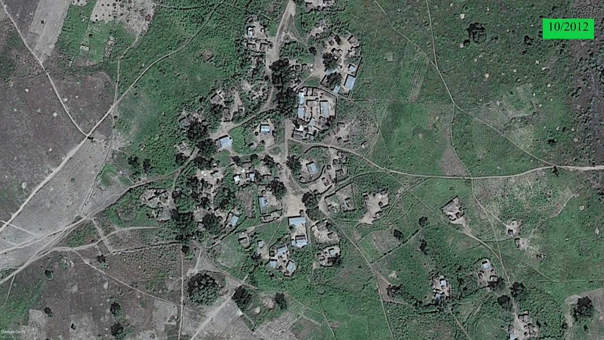
The areas around Sambisa forest are not only characterised by the build-up and expansion of settlements. They also include uprooted communities such as Tokombere, located west of the forest and south of Camp Zairo. The oldest Google Earth record of the area from 2001 shows the presence of several houses, which grew in number towards 2011.
The community became smaller in 2014 with destroyed houses visible on satellite imagery. In 2015, troops reportedly dislodged a Boko Haram camp in the village. By the following year, it had become a shadow of itself and the remains of the buildings continued to deteriorate.
Mansir Muhammed, HumAngle’s Geographic Information System (GIS) and Open Source specialist, says it is important to study this information because they help to understand patterns of settlement, displacement, and migration. Some of the clues include the appearance or disappearance of roofs, thickness of vegetation, presence of structures and pathways, and whether these structures are makeshift or permanent.
“Even minute changes enough to affect the landscape of a place do not escape the lens of the eyes in the sky,” notes Mansir.
“Depending on the extent and duration of the actions of the people on the landscape, there is often a trail marking the vestiges of activities in the area. Thanks to the readily available open source satellite imagery on different platforms, we can monitor changes, particularly with respect to security, and make assessment of situations.”
He adds that the use of satellite imagery provides a unique look into the growth of settlements in and around Sambisa alongside the impact on communities that existed in the area before the insurgency. It also shows the impact of military bombardments and the group’s survival tactic of melting away and returning to an area after the conclusion of military operations.
Support Our Journalism
There are millions of ordinary people affected by conflict in Africa whose stories are missing in the mainstream media. HumAngle is determined to tell those challenging and under-reported stories, hoping that the people impacted by these conflicts will find the safety and security they deserve.
To ensure that we continue to provide public service coverage, we have a small favour to ask you. We want you to be part of our journalistic endeavour by contributing a token to us.
Your donation will further promote a robust, free, and independent media.
Donate HereStay Closer To The Stories That Matter