Surveillance Technologies Could Reduce Security Risks In Northwest Nigeria
Surveillance sensors can be used to improve the early detection of threats and responses. They also provide tools for understanding the developmental needs of at-risk communities.
Surveillance technologies have the potential to improve the early detection of crime as well as responses to the activities of terror gangs in Nigeria’s restive Northwest region. The effectiveness of these systems would, however, depend on support systems and security policies.
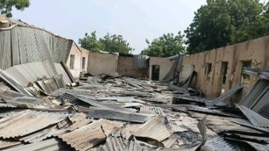
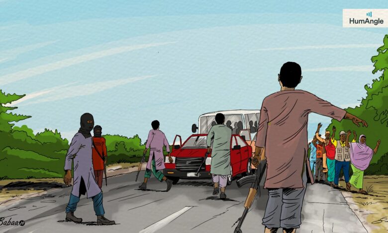
The activities of the ruthless terror gangs, often referred to as bandits, have significantly impacted the lives of vulnerable segments of the population, particularly residents of rural communities, students, and commuters. The security crisis has also triggered the displacement of hundreds of thousands of people seeking refuge in safer communities within the region and Maradi in southern Niger Republic.
According to a 2020 International Crisis Group report, the violence is rooted in competition over resources between herders and farmers, both of whom have over time mobilised armed groups, the “bandits” and “vigilantes”, for protection. Other factors fueling the security crisis include cattle rustling, kidnapping for ransom, and infiltration by violent extremist groups.
The Crisis Group report also highlighted that the region’s geography and climatic conditions pose serious challenges for federal and state authorities. “Much of the North West is savannah, but the region is also interspersed with vast forests” some of which are said to be home to thousands of mostly herders. “Once under the watch of forestry authorities, these forests gradually became hideouts for criminals,” the report added.
Over the years, neglected and unprotected forests, including designated forest reserves, national parks, and game reserves such as the Kwiambana game reserve in Zamfara and the adjacent Kamuku National Park in the Birnin Gwari axis of Kaduna, have become sanctuaries and operational bases for terror gangs to keep rustled animals, hostages and to launch violent raids on communities and highways.
Insecure conservation forest areas include the Falgore game reserve in Kano and the Ruma and Kukar Jangarai reserve, known as Rugu Forest in Katsina, that extends to the Niger Republic. Others are the Alawa Reserve and the Kainji national park, both in the neighbouring north-central state of Niger. The Kainji park also stretches to Kwara and includes the Borgu and Zugurma reserves.
The intertwined nature of the region’s savannah woodlands has contributed to the spilling over of the crisis. They provide concealment and obstacles against security forces grappling with insufficient knowledge of the environment, support equipment, and intelligence. The use of air raids has allowed the military to employ lethal force in areas out of the reach of ground forces.
The military employs drones and aircraft for surveillance but the capacity is limited because of urgent needs in other conflict areas and the inadequate number of specialised reconnaissance aircraft. This was exacerbated by the loss of two Beechcraft KingAir B350i in Feb. and May 2021.
Sensors and security
Ground and airborne sensor technologies can serve as force multipliers and tools for understanding the behavioural pattern of numerous terror gangs as well as the nature of the terrains. This would allow security forces to gain tactical and strategic advantages crucial to improving the security conditions in the region.
Optimum utilisation of this approach also depends significantly on the quality of support infrastructure as well as manpower managing the system and responding to threats. “They can’t replace them. Once a threat has been identified, someone needs to react,” says Fasasi Tosin, the founder of Demfas Aerosystems.
He adds that the use of integrated Information and Communications Technology (ICT) systems depends on user needs, either for addressing highway kidnapping or combating the presence of criminals in forest areas.
Tosin believes that the deployment of long-range cameras equipped with infrared thermal imaging capabilities would be useful for addressing kidnapping. These cameras, he says, have a human detection range of between 5 to 8 km and an identification range of 3 to 5 km. With this, the system should be able to identify weapons on an individual.
When placed in strategic locations, all-weather, day and night imaging capabilities supported by motion sensors improve the ability to detect and track movements of armed groups, especially along crossing and logistics routes. An integrated network with algorithms enhances the classification, isolation, and monitoring of threats on foot or moving in a convoy of motorcycles.
At this stage, the command centre has sufficient time to analyse the threat and rapidly dispatch a response team through the use of aircraft or mobile transport to interdict the group heading to a highway or a community.
Real-time information from other ground-based systems, including surveillance radars, can be complemented with airborne platforms such as drones and commercial or government-owned satellites capable of providing a wide range of geospatial data for accurate mapping, planning, and conduct of security interventions.
Drones also provide law enforcement with a platform for routine patrol of hot spots, evidence gathering, and deployment in support of a quick response force.
These multipurpose monitoring networks can also be deployed for understanding the interaction between local settlements and the forest areas, for instance, to understand social needs and improve the livelihood of herders. This approach could be useful for curbing social grievances and improving cooperation.
Additionally, sensor technology can be used to discourage poaching and promote wildlife conservation as well as border security to stop the proliferation of arms and contrabands.
Support Our Journalism
There are millions of ordinary people affected by conflict in Africa whose stories are missing in the mainstream media. HumAngle is determined to tell those challenging and under-reported stories, hoping that the people impacted by these conflicts will find the safety and security they deserve.
To ensure that we continue to provide public service coverage, we have a small favour to ask you. We want you to be part of our journalistic endeavour by contributing a token to us.
Your donation will further promote a robust, free, and independent media.
Donate HereStay Closer To The Stories That Matter