Floods Displace Thousands In Kogi Communities

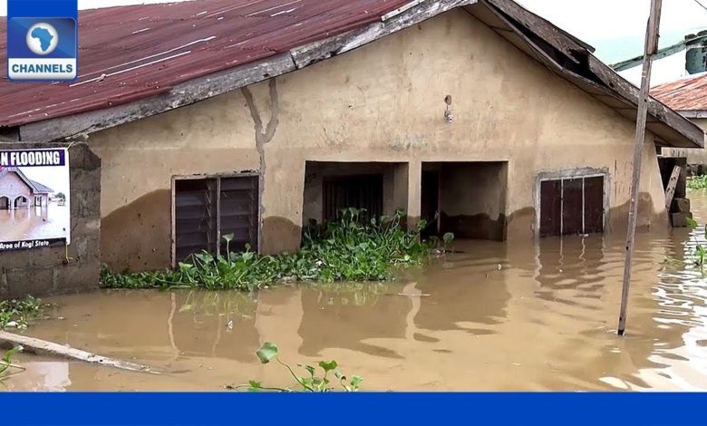
Torrential rainfall accompanied by flooding has displaced thousands of people and submerged homes in many communities in Kogi State, North Central Nigeria.
The Nigeria Hydrological Services Agency annual flood outlook had predicted that about 10 local government areas in the state would be affected by flooding during the year.
The agency named the local government areas as Lokoja, Kogi/Kotonkarfe, Ajaokuta, Bassa, Ibaji, Idah, Igalamela, Ofu, Adavi and Omala.
In September, over 50,000 people were estimated to have been displaced by flooding in the state.
The fact was made known at a one-day meeting organised by the National Emergency Management Agency and Kogi State Emergency Management Agency.
At the weekend, major roads connecting Lokoja, Kogi East and the Southeast were overrun by a rapid rise of River Niger, forcing stranded residents to use canoes.
The State House of Assembly Quarters along Ganaja village was also submerged by floodwaters.
Flooding is a reoccurring environmental disaster in Kogi State, as the state is located at the confluence of Rivers Niger and Benue.
In 2012, Kogi State witnessed one of the worst flood disasters which led to deaths and displacement of over 600,000 people as well as the destruction of farmlands and property.
Support Our Journalism
There are millions of ordinary people affected by conflict in Africa whose stories are missing in the mainstream media. HumAngle is determined to tell those challenging and under-reported stories, hoping that the people impacted by these conflicts will find the safety and security they deserve.
To ensure that we continue to provide public service coverage, we have a small favour to ask you. We want you to be part of our journalistic endeavour by contributing a token to us.
Your donation will further promote a robust, free, and independent media.
Donate HereStay Closer To The Stories That Matter


